Monitoring the construction of the underwater construction site
During submarine/underwater works, most often when performing underwater excavations, it is
difficult for the contractor to know at all times whether he has exceeded the excavation or not
reached a certain depth of excavation. Most often, in the field of excavation, it is a combination of both.
Due to this uncertainty, especially when working at depths greater than 10m, it is important to
frequently perform control bathymetric measurements where the positions that need to be corrected
are precisely determined. The more efficiently this is done, the better quality and faster the
underwater works, and thus the execution costs are significantly reduced.
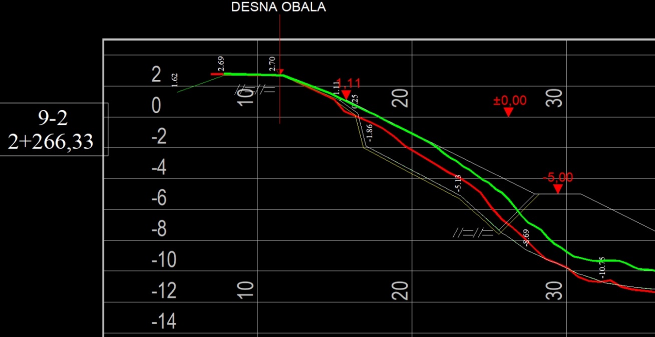
 The situation of the right bank of the Neretva (hypsometric scale display) with indicated control profiles
 Overlap of control profiles before and after the first two phases of embankment works
When we have high-quality spatial data from the various construction phases, the calculation
of cubic volumes is unambiguous, simple and precise, so that the investor and the contractor can be
assured of safety when evaluating the quantity and quality of the works performed.
 Calculation of volume by software, comparison of 3D models before and
after works on the construction of the sports port of Brigi-Lokvice
Calculation of volume by software, comparison of 3D models before and
after works on the construction of the sports port of Brigi-Lokvice
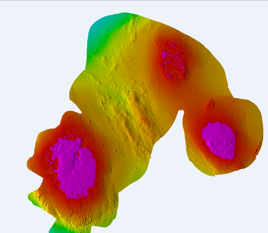 Display of the area that needs to be finished (excavated) to the given depth - marked in purple